Paraguay Map Reference
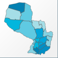 |
Map: Paraguay |
|---|---|
| File Path: south_america\paraguay.amap | |
| Bounds: (-62.6437683105469,-19.2994270324707,-54.243896484375,-27.5883369445801) | |
| Default Projection: orthographic |
Map Built-In Data Table
| REGION_ID (K) | REGION_NAME (K) | CENTROID_X | CENTROID_Y |
|---|---|---|---|
| PRY-AMM | Amambay | -56.1359786987305 | -22.9440288543701 |
| PRY-APA | Alto Parana | -54.8905029296875 | -25.3618059158325 |
| PRY-APR | Alto Paraguay | -58.8786067962646 | -20.8994388580322 |
| PRY-BQR | Boqueron | -61.0184097290039 | -22.7340269088745 |
| PRY-CAA | Caaguazu | -55.8568077087402 | -25.1860799789429 |
| PRY-CAZ | Caazapa | -56.0470848083496 | -26.1435928344727 |
| PRY-CHA | Chaco | -60.5044555664063 | -20.1502094268799 |
| PRY-CNC | Concepcion | -57.0591697692871 | -22.7985534667969 |
| PRY-CNN | Canindeyu | -55.1465339660645 | -24.0574998855591 |
| PRY-CNT | Central | -57.4829940795898 | -25.5465908050537 |
| PRY-CRD | Cordillera | -56.9787750244141 | -25.273473739624 |
| PRY-GUA | Guaira | -56.3469047546387 | -25.8751335144043 |
| PRY-ITA | Itapua | -55.6821670532227 | -26.8461303710938 |
| PRY-MSN | Misiones | -57.1055603027344 | -26.9258346557617 |
| PRY-NAS | Nueva Asuncion | -61.0772914886475 | -21.0779094696045 |
| PRY-NMB | Neembucu | -57.8355598449707 | -26.5925045013428 |
| PRY-PHA | Presidente Hayes | -59.0459747314453 | -23.7092704772949 |
| PRY-PRG | Paraguari | -57.1796607971191 | -26.0182361602783 |
| PRY-SPE | San Pedro | -56.6323738098145 | -24.1543064117432 |
![]()