Papua New Guinea Map Reference
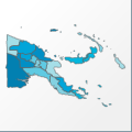 |
Map: Papua New Guinea |
|---|---|
| File Path: oceania\papua_new_guinea.amap | |
| Bounds: (140.858856201172,-1.35527777671814,155.967742919922,-11.6424999237061) | |
| Default Projection: orthographic |
Map Built-In Data Table
| REGION_ID (K) | REGION_NAME (K) | GMI_ADMIN (K) | CENTROID_X | CENTROID_Y |
|---|---|---|---|---|
| PP | West Sepik | PNG-WSE | 142.037826538086 | -3.9470841884613 |
| PP01 | Central | PNG-CNT | 148.021583557129 | -9.03687739372253 |
| PP02 | Gulf | PNG-GUL | 144.848045349121 | -7.63071966171265 |
| PP03 | Milne Bay | PNG-MBA | 151.635879516602 | -10.03125 |
| PP04 | Northern | PNG-NRT | 148.237808227539 | -8.95560193061829 |
| PP05 | Southern Highlands | PNG-SHG | 143.387046813965 | -5.84377837181091 |
| PP06 | Western | PNG-WST | 142.408432006836 | -7.12013864517212 |
| PP07 | Northern Solomons | PNG-NSL | 156.824829101563 | -5.15416669845581 |
| PP08 | Chimbu | PNG-CHM | 144.891845703125 | -6.26719546318054 |
| PP09 | Eastern Highlands | PNG-EHG | 145.56615447998 | -6.4885950088501 |
| PP10 | East New Britain | PNG-ENB | 151.495964050293 | -5.14291715621948 |
| PP11 | East Sepik | PNG-ESE | 142.986228942871 | -4.23099303245544 |
| PP12 | Madang | PNG-MDN | 145.60082244873 | -5.00688791275024 |
| PP13 | Manus | PNG-MAN | 145.345657348633 | -1.72541666030884 |
| PP14 | Morobe | PNG-MOR | 146.975120544434 | -6.64208221435547 |
| PP15 | New Ireland | PNG-NIR | 151.599990844727 | -3.08930575847626 |
| PP16 | Western Highlands | PNG-WHG | 144.405052185059 | -5.766033411026 |
| PP17 | West New Britain | PNG-WNB | 150.027435302734 | -5.48527812957764 |
| PP19 | Enga | PNG-ENG | 143.50830078125 | -5.43811392784119 |
| PP20 | National Capital | PNG-NCP | 147.187103271484 | -9.424889087677 |
![]()