UK - Northern Ireland Map Reference
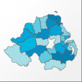 |
Map: UK - Northern Ireland |
|---|---|
| File Path: europe\uk_northern_ireland.amap | |
| Bounds: (-8.17166709899902,55.3086090087891,-5.43055582046509,54.0275001525879) | |
| Default Projection: orthographic |
Map Built-In Data Table
| REGION_ID (K) | REGION_NAME (K) | CENTROID_X | CENTROID_Y |
|---|---|---|---|
| GBR-NIR-ANT | Antrim | -6.24958348274231 | 54.6994400024414 |
| GBR-NIR-ARD | Ards | -5.62694501876831 | 54.5011043548584 |
| GBR-NIR-ARM | Armagh | -6.62000060081482 | 54.322774887085 |
| GBR-NIR-BLF | Belfast | -5.93680596351624 | 54.6016693115234 |
| GBR-NIR-BLL | Ballymena | -6.22750115394592 | 54.9024963378906 |
| GBR-NIR-BLY | Ballymoney | -6.40317249298096 | 55.0299949645996 |
| GBR-NIR-BNB | Banbridge | -6.17152810096741 | 54.3431911468506 |
| GBR-NIR-CKS | Cookstown | -6.75347256660461 | 54.6448554992676 |
| GBR-NIR-CLR | Coleraine | -6.68875050544739 | 55.0658302307129 |
| GBR-NIR-CRG | Craigavon | -6.39704155921936 | 54.4731903076172 |
| GBR-NIR-CRR | Carrickfergus | -5.79618120193481 | 54.7295799255371 |
| GBR-NIR-CST | Castlereagh | -5.85402798652649 | 54.5492992401123 |
| GBR-NIR-DNG | Dungannon | -6.95956158638 | 54.4493007659912 |
| GBR-NIR-DOW | Down | -5.80611181259155 | 54.3306903839111 |
| GBR-NIR-FRM | Fermanagh | -7.65652799606323 | 54.3590793609619 |
| GBR-NIR-LAR | Larne | -5.89423656463623 | 54.9036102294922 |
| GBR-NIR-LMV | Limavady | -6.97138953208923 | 55.0026359558105 |
| GBR-NIR-LND | Londonderry | -7.21250414848328 | 54.9382095336914 |
| GBR-NIR-LSB | Lisburn | -6.0822229385376 | 54.4995784759521 |
| GBR-NIR-MGH | Magherafelt | -6.71987199783325 | 54.8205013275146 |
| GBR-NIR-MOY | Moyle | -6.2622230052948 | 55.1456890106201 |
| GBR-NIR-NAM | Newry and Mourne | -6.26764011383057 | 54.1522197723389 |
| GBR-NIR-NDO | North Down | -5.71829509735107 | 54.6469402313232 |
| GBR-NIR-NWT | Newtownabbey | -5.98111152648926 | 54.7223606109619 |
| GBR-NIR-OMG | Omagh | -7.31152844429016 | 54.5911102294922 |
| GBR-NIR-STR | Strabane | -7.41138958930969 | 54.7723045349121 |
![]()