UK - England Map Reference
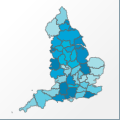 |
Map: UK - England |
|---|---|
| File Path: europe\uk_england.amap | |
| Bounds: (-6.33166694641113,55.8061103820801,1.77111101150513,49.9116592407227) | |
| Default Projection: orthographic |
Map Built-In Data Table
| REGION_ID (K) | REGION_NAME (K) | CENTROID_X | CENTROID_Y |
|---|---|---|---|
| GBR-ENG-AVO | Avon | -2.61736142635345 | 51.4724788665771 |
| GBR-ENG-BCK | Buckinghamshire | -0.806551486253738 | 51.8341655731201 |
| GBR-ENG-BDF | Bedfordshire | -0.40930599719286 | 52.0552444458008 |
| GBR-ENG-BRK | Berkshire | -1.04862299561501 | 51.4465198516846 |
| GBR-ENG-CHS | Cheshire | -2.53772854804993 | 53.20485496521 |
| GBR-ENG-CLV | Cleveland | -1.10694450139999 | 54.593189239502 |
| GBR-ENG-CMB | Cambridgeshire | 0.0132599920034409 | 52.3638801574707 |
| GBR-ENG-CMR | Cumbria | -2.89222252368927 | 54.6199703216553 |
| GBR-ENG-CRN | Cornwall | -5.27083396911621 | 50.4069404602051 |
| GBR-ENG-DEV | Devonshire | -3.7783340215683 | 50.7248592376709 |
| GBR-ENG-DRB | Derbyshire | -1.58944445848465 | 53.1083297729492 |
| GBR-ENG-DRH | Durham | -1.8016664981842 | 54.6731948852539 |
| GBR-ENG-DRS | Dorsetshire | -2.31076401472092 | 50.8033294677734 |
| GBR-ENG-ESS | East Sussex | 0.321111001074314 | 50.9413890838623 |
| GBR-ENG-ESX | Essex | 0.64124997658655 | 51.7641639709473 |
| GBR-ENG-GLC | Gloucestershire | -2.15041697025299 | 51.8415260314941 |
| GBR-ENG-GLN | Greater London | -0.0805389881134033 | 51.4858245849609 |
| GBR-ENG-GMN | Greater Manchest | -2.3246054649353 | 53.5089683532715 |
| GBR-ENG-HAW | Hereford and Wor | -2.44375056028366 | 52.1297492980957 |
| GBR-ENG-HMB | Humberside | -0.477777510881424 | 53.798469543457 |
| GBR-ENG-HMP | Hampshire | -1.3376390337944 | 51.0432243347168 |
| GBR-ENG-HRT | Hertfordshire | -0.265416510403156 | 51.8303546905518 |
| GBR-ENG-IOW | Isle of Wight | -1.3148609995842 | 50.6750011444092 |
| GBR-ENG-KEN | Kent | 0.746851997449994 | 51.2002735137939 |
| GBR-ENG-LCS | Leicestershire | -0.99916698038578 | 52.6697750091553 |
| GBR-ENG-LNC | Lancashire | -2.54611647129059 | 53.8647155761719 |
| GBR-ENG-LNL | Lincolnshire | -0.226666480302811 | 53.1222896575928 |
| GBR-ENG-MRS | Merseyside | -2.87931406497955 | 53.4933986663818 |
| GBR-ENG-NRF | Norfolkshire | 0.953029975295067 | 52.6680507659912 |
| GBR-ENG-NRH | Northumberland | -2.06851094961166 | 55.2923603057861 |
| GBR-ENG-NRT | Northamptonshire | -0.82837401330471 | 52.3064556121826 |
| GBR-ENG-NTT | Nottinghamshire | -0.983194530010223 | 53.1298942565918 |
| GBR-ENG-NYR | North Yorkshire | -1.37595898658037 | 54.0883293151855 |
| GBR-ENG-OXF | Oxfordshire | -1.28874999284744 | 51.8048210144043 |
| GBR-ENG-SAL | Salop | -2.72055554389954 | 52.6466045379639 |
| GBR-ENG-SFF | Suffolk | 1.06041650474072 | 52.2352752685547 |
| GBR-ENG-SMR | Somersetshire | -3.03166651725769 | 51.0750255584717 |
| GBR-ENG-SRR | Surrey | -0.388055488467216 | 51.2743511199951 |
| GBR-ENG-STF | Staffordshire | -2.01513904333115 | 52.8177700042725 |
| GBR-ENG-SYR | South Yorkshire | -1.33569449186325 | 53.4748592376709 |
| GBR-ENG-TAW | Tyne and Wear | -1.59805601835251 | 54.9346103668213 |
| GBR-ENG-WLT | Wiltshire | -1.91888850927353 | 51.324161529541 |
| GBR-ENG-WMD | West Midlands | -1.81611150503159 | 52.5012493133545 |
| GBR-ENG-WRW | Warwickshire | -1.5548614859581 | 52.3159656524658 |
| GBR-ENG-WSS | West Sussex | -0.457916492596269 | 50.9433250427246 |
| GBR-ENG-WYR | West Yorkshire | -1.68541651964188 | 53.7393989562988 |
![]()