Sweden Map Reference
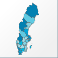 |
Map: Sweden |
|---|---|
| File Path: europe\sweden.amap | |
| Bounds: (11.1069431304932,69.060302734375,24.1670074462891,55.3391647338867) | |
| Default Projection: orthographic |
Map Built-In Data Table
| REGION_ID (K) | REGION_NAME (K) | CENTROID_X | CENTROID_Y |
|---|---|---|---|
| SWE-ALV | Alvsborgs | 12.6602153778076 | 58.1817436218262 |
| SWE-BLK | Blekinge | 15.2168045043945 | 56.2448577880859 |
| SWE-GOB | Goteborgs Och Bohus | 11.8293046951294 | 58.3074989318848 |
| SWE-GTL | Gotlands | 18.7227745056152 | 57.650691986084 |
| SWE-GVL | Gavleborgs | 15.9810647964478 | 61.2510452270508 |
| SWE-HLL | Hallands | 12.7848110198975 | 56.9495811462402 |
| SWE-JMT | Jamtlands | 14.4705533981323 | 63.3260612487793 |
| SWE-JNK | Jonkopings | 14.3343787193298 | 57.4977722167969 |
| SWE-KLM | Kalmar | 16.2391653060913 | 57.1631889343262 |
| SWE-KPP | Kopparbergs | 14.4048957824707 | 61.0467147827148 |
| SWE-KRN | Kronobergs | 14.5576372146606 | 56.7959671020508 |
| SWE-KRS | Kristianstads | 13.5983324050903 | 55.9494590759277 |
| SWE-MLM | Malmohus | 13.322606086731 | 55.8187484741211 |
| SWE-NRR | Norrbottens | 19.7656936645508 | 67.0583419799805 |
| SWE-ORB | Orebro | 15.0116987228394 | 59.3734664916992 |
| SWE-OST | Ostergotlands | 15.6219434738159 | 58.3424949645996 |
| SWE-SDR | Sodermanlands | 16.6129150390625 | 59.0537452697754 |
| SWE-SKR | Skaraborgs | 13.6138210296631 | 58.4227714538574 |
| SWE-STC | Stockholms | 18.1622219085693 | 59.5059700012207 |
| SWE-UPP | Uppsala | 17.6648597717285 | 60.0562438964844 |
| SWE-VRM | Varmlands | 13.0682621002197 | 59.8786277770996 |
| SWE-VSM | Vastmanlands | 16.3759984970093 | 59.7448272705078 |
| SWE-VSR | Vasternorrlands | 17.0468139648438 | 63.054515838623 |
| SWE-VST | Vasterbottens | 17.9407186508179 | 64.8755493164063 |
![]()