Netherlands Map Reference
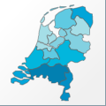 |
Map: Netherlands |
|---|---|
| File Path: europe\netherlands.amap | |
| Bounds: (3.37086582183838,53.5113830566406,7.21027755737305,50.7538833618164) | |
| Default Projection: orthographic |
Map Built-In Data Table
| REGION_ID (K) | REGION_NAME (K) | CENTROID_X | CENTROID_Y |
|---|---|---|---|
| NLD-DRN | Drenthe | 6.61029624938965 | 52.9149971008301 |
| NLD-FLV | Flevoland | 5.55745935440063 | 52.5527725219727 |
| NLD-FRS | Friesland | 5.65902709960938 | 53.1578712463379 |
| NLD-GLD | Gelderland | 5.92046546936035 | 52.1282348632813 |
| NLD-GRN | Groningen | 6.68861055374146 | 53.1513671875 |
| NLD-LMB | Limburg | 5.89555549621582 | 51.2662467956543 |
| NLD-NBR | Noord-Brabant | 5.11747455596924 | 51.5253524780273 |
| NLD-NHL | Noord-Holland | 4.99030256271362 | 52.6820793151855 |
| NLD-OVR | Overijssel | 6.42745685577393 | 52.4839210510254 |
| NLD-UTR | Utrecht | 5.19444417953491 | 52.1103515625 |
| NLD-ZHL | Zuid-Holland | 4.52374625205994 | 51.9887466430664 |
| NLD-ZLN | Zeeland | 3.82526969909668 | 51.4759712219238 |
![]()