France Map Reference
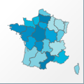 |
Map: France |
|---|---|
| File Path: europe\france.amap | |
| Bounds: (-5.13472270965576,51.0911102294922,9.56222152709961,41.3647155761719) | |
| Default Projection: orthographic |
Map Built-In Data Table
| REGION_ID (K) | REGION_NAME (K) | CENTROID_X | CENTROID_Y |
|---|---|---|---|
| FRA-ALS | Alsace | 7.54581642150879 | 48.2374954223633 |
| FRA-AQT | Aquitaine | -0.1611328125 | 44.244441986084 |
| FRA-AVR | Auvergne | 3.2686619758606 | 45.7109680175781 |
| FRA-BNR | Basse-Normandie | -0.479722321033478 | 48.9530487060547 |
| FRA-BOR | Bourgogne | 4.19430541992188 | 47.2912673950195 |
| FRA-BRT | Bretagne | -3.0841668844223 | 48.0791625976563 |
| FRA-CEN | Centre | 1.59263876080513 | 47.645133972168 |
| FRA-CHA | Champagne-Ardenne | 4.6431941986084 | 48.8766632080078 |
| FRA-COR | Corse | 9.06638813018799 | 42.1873588562012 |
| FRA-FRC | Franche-Comte | 6.20097160339355 | 47.137077331543 |
| FRA-HNR | Haute-Normandie | 0.917777709662914 | 49.3653869628906 |
| FRA-IDF | Ile-del-France | 2.51111090183258 | 48.6754150390625 |
| FRA-LIM | Limousin | 1.61819434165955 | 45.6829109191895 |
| FRA-LNR | Languedoc-Roussillon | 3.27166640758514 | 43.646800994873 |
| FRA-LOR | Lorraine | 6.27618312835693 | 48.7207183837891 |
| FRA-MPY | Midi-Pyrenees | 1.56694427132607 | 43.8088684082031 |
| FRA-NPC | Nord-Pas-de-Calais | 2.87624955177307 | 50.5297203063965 |
| FRA-PAC | Provence-Alpes-Cote d'Azur | 5.97523927688599 | 44.0888862609863 |
| FRA-PCH | Poitou-Charentes | -0.174444556236267 | 46.132625579834 |
| FRA-PDL | Pays de la Loire | -0.847361207008362 | 47.4174957275391 |
| FRA-PIC | Picardie | 2.81343698501587 | 49.6080513000488 |
| FRA-RHA | Rhone-Alpes | 5.42555499076843 | 45.3165245056152 |
![]()