South Africa Map Reference
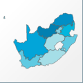 |
Map: South Africa |
|---|---|
| File Path: africa\south_africa.amap | |
| Bounds: (14.408332824707,-22.1363906860352,32.8904266357422,-34.8220024108887) | |
| Default Projection: orthographic |
Map Built-In Data Table
| REGION_ID (K) | REGION_NAME (K) | CENTROID_X | CENTROID_Y |
|---|---|---|---|
| ZAF-ECP | Eastern Cape | 26.4599199295044 | -32.0823640823364 |
| ZAF-GAT | Gauteng | 28.2126350402832 | -26.0064277648926 |
| ZAF-KNT | KwaZulu/Natal | 30.8203506469727 | -28.9395065307617 |
| ZAF-MPM | Mpumalanga | 30.1535720825195 | -25.7311573028564 |
| ZAF-NCP | Northern Cape | 21.0040245056152 | -28.8511791229248 |
| ZAF-NRT | Northern | 29.1375951766968 | -23.7331953048706 |
| ZAF-NWS | North West | 25.4592094421387 | -26.3593416213989 |
| ZAF-OFS | Free State | 27.0558490753174 | -28.7026424407959 |
| ZAF-PS1 | Walvis Bay | 14.5605545043945 | -22.9209728240967 |
| ZAF-WCP | Western Cape | 20.9858541488647 | -32.6254463195801 |
![]()