Wyoming Map Reference
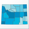 |
Map: Wyoming |
|---|---|
| File Path: usa\states\counties\wy.amap | |
| Bounds: (-111.05265045166,45.0028533935547,-104.051200866699,40.9943046569824) | |
| Default Projection: orthographic |
Map Built-In Data Table
| REGION_ID (K) | REGION_NAME (K) | CENTROID_X | CENTROID_Y |
|---|---|---|---|
| 56001 | Albany | -105.802108764648 | 41.7155799865723 |
| 56003 | Big Horn | -107.883430480957 | 44.5792675018311 |
| 56005 | Campbell | -105.549224853516 | 44.2474060058594 |
| 56007 | Carbon | -107.003536224365 | 41.7195014953613 |
| 56009 | Converse | -105.490955352783 | 42.8963584899902 |
| 56011 | Crook | -104.572582244873 | 44.5914669036865 |
| 56013 | Fremont | -108.778324127197 | 43.1335697174072 |
| 56015 | Goshen | -104.354808807373 | 42.0894756317139 |
| 56017 | Hot Springs | -108.452816009521 | 43.7728633880615 |
| 56019 | Johnson | -106.690860748291 | 44.0259780883789 |
| 56021 | Laramie | -104.665882110596 | 41.3253479003906 |
| 56023 | Lincoln | -110.55150604248 | 42.4322261810303 |
| 56025 | Natrona | -106.807571411133 | 42.9697017669678 |
| 56027 | Niobrara | -104.48518371582 | 43.0578498840332 |
| 56029 | Park | -109.80464553833 | 44.4048347473145 |
| 56031 | Platte | -104.969161987305 | 42.1343536376953 |
| 56033 | Sheridan | -106.952087402344 | 44.7781219482422 |
| 56035 | Sublette | -109.838172912598 | 42.8640785217285 |
| 56037 | Sweetwater | -108.785575866699 | 41.6321067810059 |
| 56039 | Teton | -110.551990509033 | 43.9459781646729 |
| 56041 | Uinta | -110.550792694092 | 41.2894515991211 |
| 56043 | Washakie | -107.83472442627 | 43.8357124328613 |
| 56045 | Weston | -104.570457458496 | 43.8415699005127 |
![]()