Oklahoma Map Reference
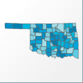 |
Map: Oklahoma |
|---|---|
| File Path: usa\states\counties\ok.amap | |
| Bounds: (-102.997222900391,37.001407623291,-94.428337097168,33.621021270752) | |
| Default Projection: orthographic |
Map Built-In Data Table
| REGION_ID (K) | REGION_NAME (K) | CENTROID_X | CENTROID_Y |
|---|---|---|---|
| 40001 | Adair | -94.6378555297852 | 35.9060230255127 |
| 40003 | Alfalfa | -98.319709777832 | 36.7315101623535 |
| 40005 | Atoka | -96.0368499755859 | 34.4262104034424 |
| 40007 | Beaver | -100.477878570557 | 36.7436275482178 |
| 40009 | Beckham | -99.6775817871094 | 35.2682209014893 |
| 40011 | Blaine | -98.4178009033203 | 35.8618946075439 |
| 40013 | Bryan | -96.189208984375 | 33.93385887146 |
| 40015 | Caddo | -98.3537521362305 | 35.2061996459961 |
| 40017 | Canadian | -97.9881744384766 | 35.5296096801758 |
| 40019 | Carter | -97.2427024841309 | 34.2931880950928 |
| 40021 | Cherokee | -95.0422554016113 | 35.9085712432861 |
| 40023 | Choctaw | -95.5754737854004 | 34.0153865814209 |
| 40025 | Cimarron | -102.510646820068 | 36.7443561553955 |
| 40027 | Cleveland | -97.4047203063965 | 35.1618576049805 |
| 40029 | Coal | -96.3007736206055 | 34.5993423461914 |
| 40031 | Comanche | -98.4572410583496 | 34.6338291168213 |
| 40033 | Cotton | -98.3971328735352 | 34.2816333770752 |
| 40035 | Craig | -95.2162742614746 | 36.7595443725586 |
| 40037 | Creek | -96.3259201049805 | 35.9073829650879 |
| 40039 | Custer | -98.996883392334 | 35.640998840332 |
| 40041 | Delaware | -94.7842864990234 | 36.4214324951172 |
| 40043 | Dewey | -99.0081672668457 | 35.9902267456055 |
| 40045 | Ellis | -99.6934356689453 | 36.2221546173096 |
| 40047 | Garfield | -97.7786483764648 | 36.381383895874 |
| 40049 | Garvin | -97.2980194091797 | 34.6902332305908 |
| 40051 | Grady | -97.8798942565918 | 35.0309066772461 |
| 40053 | Grant | -97.7833824157715 | 36.7949771881104 |
| 40055 | Greer | -99.5648574829102 | 34.9198608398438 |
| 40057 | Harmon | -99.8286056518555 | 34.7663879394531 |
| 40059 | Harper | -99.6456680297852 | 36.79465675354 |
| 40061 | Haskell | -95.1307106018066 | 35.267110824585 |
| 40063 | Hughes | -96.2335777282715 | 35.0331344604492 |
| 40065 | Jackson | -99.4373359680176 | 34.594030380249 |
| 40067 | Jefferson | -97.830509185791 | 34.0745086669922 |
| 40069 | Johnston | -96.6660614013672 | 34.3187942504883 |
| 40071 | Kay | -97.1067352294922 | 36.7965984344482 |
| 40073 | Kingfisher | -97.939769744873 | 35.9493942260742 |
| 40075 | Kiowa | -99.0074272155762 | 34.8564300537109 |
| 40077 | Latimer | -95.2195091247559 | 34.8762340545654 |
| 40079 | Le Flore | -94.7416687011719 | 34.9543914794922 |
| 40081 | Lincoln | -96.878116607666 | 35.7080936431885 |
| 40083 | Logan | -97.408878326416 | 35.9467144012451 |
| 40085 | Love | -97.2426834106445 | 33.9004154205322 |
| 40087 | McClain | -97.2976112365723 | 35.0986862182617 |
| 40089 | McCurtain | -94.8053321838379 | 34.0655879974365 |
| 40091 | McIntosh | -95.6584777832031 | 35.3560791015625 |
| 40093 | Major | -98.5292739868164 | 36.3347988128662 |
| 40095 | Marshall | -96.7586975097656 | 34.0076389312744 |
| 40097 | Mayes | -95.2269668579102 | 36.2995052337646 |
| 40099 | Murray | -97.0857620239258 | 34.4913749694824 |
| 40101 | Muskogee | -95.4162712097168 | 35.5674819946289 |
| 40103 | Noble | -97.1719093322754 | 36.3849868774414 |
| 40105 | Nowata | -95.6121788024902 | 36.8019371032715 |
| 40107 | Okfuskee | -96.2982864379883 | 35.4705295562744 |
| 40109 | Oklahoma | -97.4039993286133 | 35.5543041229248 |
| 40111 | Okmulgee | -95.9457969665527 | 35.6228771209717 |
| 40113 | Osage | -96.5368576049805 | 36.5862598419189 |
| 40115 | Ottawa | -94.8303871154785 | 36.8355903625488 |
| 40117 | Pawnee | -96.6394577026367 | 36.3654594421387 |
| 40119 | Payne | -96.9863319396973 | 36.1008625030518 |
| 40121 | Pittsburg | -95.7192039489746 | 34.9542255401611 |
| 40123 | Pontotoc | -96.664306640625 | 34.7414169311523 |
| 40125 | Pottawatomie | -96.8786392211914 | 35.1891460418701 |
| 40127 | Pushmataha | -95.3600616455078 | 34.4238529205322 |
| 40129 | Roger Mills | -99.6792182922363 | 35.7194995880127 |
| 40131 | Rogers | -95.5741271972656 | 36.3412170410156 |
| 40133 | Seminole | -96.6072959899902 | 35.1620540618896 |
| 40135 | Sequoyah | -94.7787590026855 | 35.4644203186035 |
| 40137 | Stephens | -97.8509674072266 | 34.4900894165039 |
| 40139 | Texas | -101.492176055908 | 36.7427310943604 |
| 40141 | Tillman | -98.9193382263184 | 34.3845729827881 |
| 40143 | Tulsa | -96.0302658081055 | 36.1462497711182 |
| 40145 | Wagoner | -95.5146102905273 | 35.973051071167 |
| 40147 | Washington | -95.8956413269043 | 36.7157039642334 |
| 40149 | Washita | -98.9857788085938 | 35.2855682373047 |
| 40151 | Woods | -98.9825019836426 | 36.6956081390381 |
| 40153 | Woodward | -99.2751388549805 | 36.4849510192871 |
![]()