Montana Map Reference
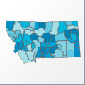 |
Map: Montana |
|---|---|
| File Path: usa\states\counties\mt.amap | |
| Bounds: (-116.0625,49,-104.042579650879,44.3537292480469) | |
| Default Projection: orthographic |
Map Built-In Data Table
| REGION_ID (K) | REGION_NAME (K) | CENTROID_X | CENTROID_Y |
|---|---|---|---|
| 30001 | Beaverhead | -112.691631317139 | 45.1458797454834 |
| 30003 | Big Horn | -107.481491088867 | 45.5181255340576 |
| 30005 | Blaine | -108.90353012085 | 48.3648071289063 |
| 30007 | Broadwater | -111.424270629883 | 46.3119068145752 |
| 30009 | Carbon | -108.959297180176 | 45.3159255981445 |
| 30011 | Carter | -104.541919708252 | 45.56760597229 |
| 30013 | Cascade | -111.34497833252 | 47.2593555450439 |
| 30015 | Chouteau | -110.479839324951 | 47.8616752624512 |
| 30017 | Custer | -105.467548370361 | 46.3260440826416 |
| 30019 | Daniels | -105.568897247314 | 48.7835597991943 |
| 30021 | Dawson | -104.86404800415 | 47.3225727081299 |
| 30023 | Deer Lodge | -113.025623321533 | 46.0049419403076 |
| 30025 | Fallon | -104.479068756104 | 46.2855644226074 |
| 30027 | Fergus | -109.263175964355 | 47.2533016204834 |
| 30029 | Flathead | -113.952079772949 | 48.2982215881348 |
| 30031 | Gallatin | -111.289752960205 | 45.3378639221191 |
| 30033 | Garfield | -107.030292510986 | 47.4140186309814 |
| 30035 | Glacier | -113.124408721924 | 48.6501350402832 |
| 30037 | Golden Valley | -109.218421936035 | 46.3991184234619 |
| 30039 | Granite | -113.447658538818 | 46.3818244934082 |
| 30041 | Hill | -110.110378265381 | 48.5661773681641 |
| 30043 | Jefferson | -112.124961853027 | 46.1528911590576 |
| 30045 | Judith Basin | -110.273258209229 | 47.0504493713379 |
| 30047 | Lake | -114.104995727539 | 47.5890197753906 |
| 30049 | Lewis and Clark | -112.333442687988 | 47.1824684143066 |
| 30051 | Liberty | -111.085742950439 | 48.5636215209961 |
| 30053 | Lincoln | -115.338401794434 | 48.4453201293945 |
| 30055 | McCone | -105.818916320801 | 47.5943870544434 |
| 30057 | Madison | -112.022274017334 | 45.276668548584 |
| 30059 | Meagher | -110.97286605835 | 46.6319561004639 |
| 30061 | Mineral | -115.083976745605 | 47.0949459075928 |
| 30063 | Missoula | -114.052139282227 | 47.1119899749756 |
| 30065 | Musselshell | -108.39820098877 | 46.4432220458984 |
| 30067 | Park | -110.42276763916 | 45.5937099456787 |
| 30069 | Petroleum | -108.283931732178 | 47.1755771636963 |
| 30071 | Phillips | -108.041614532471 | 48.2284049987793 |
| 30073 | Pondera | -112.393825531006 | 48.2285079956055 |
| 30075 | Powder River | -105.628021240234 | 45.395263671875 |
| 30077 | Powell | -112.88370513916 | 46.9309234619141 |
| 30079 | Prairie | -105.344917297363 | 46.8643569946289 |
| 30081 | Ravalli | -114.043518066406 | 46.0559062957764 |
| 30083 | Richland | -104.644538879395 | 47.7495784759521 |
| 30085 | Roosevelt | -104.947708129883 | 48.2852039337158 |
| 30087 | Rosebud | -106.992847442627 | 46.0216102600098 |
| 30089 | Sanders | -115.121711730957 | 47.6845531463623 |
| 30091 | Sheridan | -104.557060241699 | 48.6954975128174 |
| 30093 | Silver Bow | -112.625221252441 | 45.8998203277588 |
| 30095 | Stillwater | -109.452285766602 | 45.6519966125488 |
| 30097 | Sweet Grass | -109.861442565918 | 45.694314956665 |
| 30099 | Teton | -112.210472106934 | 47.8147773742676 |
| 30101 | Toole | -111.739013671875 | 48.6064758300781 |
| 30103 | Treasure | -107.33814239502 | 46.1793060302734 |
| 30105 | Valley | -106.619232177734 | 48.3326282501221 |
| 30107 | Wheatland | -109.843315124512 | 46.4856128692627 |
| 30109 | Wibaux | -104.32674407959 | 47.0205554962158 |
| 30111 | Yellowstone | -108.195163726807 | 45.9787178039551 |
| 30113 | Yellowstone National Park (Part) | -110.571720123291 | 44.7917232513428 |
![]()