Mississippi Map Reference
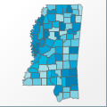 |
Map: Mississippi |
|---|---|
| File Path: usa\states\counties\ms.amap | |
| Bounds: (-91.6435623168945,35.004955291748,-88.0904312133789,30.1947383880615) | |
| Default Projection: orthographic |
Map Built-In Data Table
| REGION_ID (K) | REGION_NAME (K) | CENTROID_X | CENTROID_Y |
|---|---|---|---|
| 28001 | Adams | -91.3989105224609 | 31.4860668182373 |
| 28003 | Alcorn | -88.582088470459 | 34.8823089599609 |
| 28005 | Amite | -90.8235244750977 | 31.1797828674316 |
| 28007 | Attala | -89.6390838623047 | 33.0898551940918 |
| 28009 | Benton | -89.1743698120117 | 34.7967586517334 |
| 28011 | Bolivar | -90.9424133300781 | 33.8318862915039 |
| 28013 | Calhoun | -89.3190002441406 | 33.9454135894775 |
| 28015 | Carroll | -89.9063415527344 | 33.4525203704834 |
| 28017 | Chickasaw | -88.9460830688477 | 33.9121570587158 |
| 28019 | Choctaw | -89.2660217285156 | 33.3272743225098 |
| 28021 | Claiborne | -90.9784164428711 | 32.0099925994873 |
| 28023 | Clarke | -88.677116394043 | 32.0299882888794 |
| 28025 | Clay | -88.7479858398438 | 33.6614532470703 |
| 28027 | Coahoma | -90.6745491027832 | 34.2592658996582 |
| 28029 | Copiah | -90.4215507507324 | 31.8720235824585 |
| 28031 | Covington | -89.5737686157227 | 31.6180467605591 |
| 28033 | De Soto | -90.0112686157227 | 34.8559379577637 |
| 28035 | Forrest | -89.2893333435059 | 31.1770429611206 |
| 28037 | Franklin | -90.8943786621094 | 31.4729347229004 |
| 28039 | George | -88.6444282531738 | 30.8687925338745 |
| 28041 | Greene | -88.6319236755371 | 31.2182922363281 |
| 28043 | Grenada | -89.8180732727051 | 33.7872695922852 |
| 28045 | Hancock | -89.5009422302246 | 30.4244966506958 |
| 28047 | Harrison | -89.1036834716797 | 30.4989175796509 |
| 28049 | Hinds | -90.3960800170898 | 32.3118362426758 |
| 28051 | Holmes | -90.0867538452148 | 33.1342124938965 |
| 28053 | Humphreys | -90.5269203186035 | 33.1290149688721 |
| 28055 | Issaquena | -90.9486694335938 | 32.7298011779785 |
| 28057 | Itawamba | -88.3456726074219 | 34.2798194885254 |
| 28059 | Jackson | -88.6364860534668 | 30.5325984954834 |
| 28061 | Jasper | -89.1116600036621 | 32.0190896987915 |
| 28063 | Jefferson | -91.0510864257813 | 31.7468852996826 |
| 28065 | Jefferson Davis | -89.7778549194336 | 31.585319519043 |
| 28067 | Jones | -89.1642570495605 | 31.631462097168 |
| 28069 | Kemper | -88.6299133300781 | 32.7553615570068 |
| 28071 | Lafayette | -89.4780235290527 | 34.3659000396729 |
| 28073 | Lamar | -89.4991912841797 | 31.2136383056641 |
| 28075 | Lauderdale | -88.6551704406738 | 32.4039726257324 |
| 28077 | Lawrence | -90.101001739502 | 31.5502271652222 |
| 28079 | Leake | -89.5226783752441 | 32.7556190490723 |
| 28081 | Lee | -88.6757049560547 | 34.300708770752 |
| 28083 | Leflore | -90.2719230651855 | 33.5300426483154 |
| 28085 | Lincoln | -90.4904327392578 | 31.5398693084717 |
| 28087 | Lowndes | -88.4584693908691 | 33.5178565979004 |
| 28089 | Madison | -90.0847816467285 | 32.6461124420166 |
| 28091 | Marion | -89.8454055786133 | 31.2232322692871 |
| 28093 | Marshall | -89.4801750183105 | 34.7512016296387 |
| 28095 | Monroe | -88.4570045471191 | 33.8736629486084 |
| 28097 | Montgomery | -89.5832061767578 | 33.4858665466309 |
| 28099 | Neshoba | -89.1145553588867 | 32.757474899292 |
| 28101 | Newton | -89.1170654296875 | 32.4051532745361 |
| 28103 | Noxubee | -88.5573425292969 | 33.107852935791 |
| 28105 | Oktibbeha | -88.8734970092773 | 33.4321880340576 |
| 28107 | Panola | -89.957592010498 | 34.3633975982666 |
| 28109 | Pearl River | -89.5879440307617 | 30.743688583374 |
| 28111 | Perry | -88.9819259643555 | 31.1754713058472 |
| 28113 | Pike | -90.400577545166 | 31.1807241439819 |
| 28115 | Pontotoc | -89.0299644470215 | 34.2313652038574 |
| 28117 | Prentiss | -88.5218200683594 | 34.6148777008057 |
| 28119 | Quitman | -90.2905464172363 | 34.2988471984863 |
| 28121 | Rankin | -89.9853477478027 | 32.3261375427246 |
| 28123 | Scott | -89.5519828796387 | 32.4330787658691 |
| 28125 | Sharkey | -90.806713104248 | 32.8884334564209 |
| 28127 | Simpson | -89.9441833496094 | 31.9074640274048 |
| 28129 | Smith | -89.5246429443359 | 32.0074787139893 |
| 28131 | Stone | -89.1022872924805 | 30.7834548950195 |
| 28133 | Sunflower | -90.6068267822266 | 33.6332817077637 |
| 28135 | Tallahatchie | -90.1889533996582 | 33.9322166442871 |
| 28137 | Tate | -89.9531135559082 | 34.6716785430908 |
| 28139 | Tippah | -88.8938827514648 | 34.8036136627197 |
| 28141 | Tishomingo | -88.2222938537598 | 34.7347717285156 |
| 28143 | Tunica | -90.3928527832031 | 34.6558856964111 |
| 28145 | Union | -88.9821891784668 | 34.4890823364258 |
| 28147 | Walthall | -90.0463829040527 | 31.1831493377686 |
| 28149 | Warren | -90.8595962524414 | 32.34010887146 |
| 28151 | Washington | -90.9540786743164 | 33.2785816192627 |
| 28153 | Wayne | -88.6902542114258 | 31.6620864868164 |
| 28155 | Webster | -89.2564811706543 | 33.603385925293 |
| 28157 | Wilkinson | -91.3445434570313 | 31.1885566711426 |
| 28159 | Winston | -89.0616874694824 | 33.1052742004395 |
| 28161 | Yalobusha | -89.7179946899414 | 34.0328502655029 |
| 28163 | Yazoo | -90.3576889038086 | 32.7694473266602 |
![]()