Maryland Map Reference
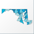 |
Map: Maryland |
|---|---|
| File Path: usa\states\counties\md.amap | |
| Bounds: (-79.4900894165039,39.7253684997559,-75.0930938720703,37.9701309204102) | |
| Default Projection: orthographic |
Map Built-In Data Table
| REGION_ID (K) | REGION_NAME (K) | CENTROID_X | CENTROID_Y |
|---|---|---|---|
| 24001 | Allegany | -78.6878318786621 | 39.5812187194824 |
| 24003 | Anne Arundel | -76.6338233947754 | 38.9683837890625 |
| 24005 | Baltimore | -76.6309700012207 | 39.4645366668701 |
| 24009 | Calvert | -76.5436935424805 | 38.543025970459 |
| 24011 | Caroline | -75.864372253418 | 38.8955497741699 |
| 24013 | Carroll | -77.0504379272461 | 39.526460647583 |
| 24015 | Cecil | -76.0030708312988 | 39.5514469146729 |
| 24017 | Charles | -76.9762077331543 | 38.501916885376 |
| 24019 | Dorchester | -76.000846862793 | 38.4798355102539 |
| 24021 | Frederick | -77.396369934082 | 39.4696063995361 |
| 24023 | Garrett | -79.2102584838867 | 39.4597702026367 |
| 24025 | Harford | -76.3249893188477 | 39.548318862915 |
| 24027 | Howard | -76.9425086975098 | 39.2305774688721 |
| 24029 | Kent | -76.0002746582031 | 39.2392616271973 |
| 24031 | Montgomery | -77.2031593322754 | 39.1397285461426 |
| 24033 | Prince Georges | -76.8824119567871 | 38.8303413391113 |
| 24035 | Queen Annes | -76.0642433166504 | 39.061559677124 |
| 24037 | St. Marys | -76.5971755981445 | 38.2794895172119 |
| 24039 | Somerset | -75.7214546203613 | 38.1318130493164 |
| 24041 | Talbot | -76.1259384155273 | 38.7600269317627 |
| 24043 | Washington | -77.914909362793 | 39.5215320587158 |
| 24045 | Wicomico | -75.6058616638184 | 38.4081745147705 |
| 24047 | Worcester | -75.3543815612793 | 38.2258129119873 |
| 24510 | Baltimore City | -76.6219787597656 | 39.2835254669189 |
![]()