Iowa Map Reference
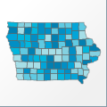 |
Map: Iowa |
|---|---|
| File Path: usa\states\counties\ia.amap | |
| Bounds: (-96.6403961181641,43.5014953613281,-90.1426696777344,40.3719024658203) | |
| Default Projection: orthographic |
Map Built-In Data Table
| REGION_ID (K) | REGION_NAME (K) | CENTROID_X | CENTROID_Y |
|---|---|---|---|
| 19001 | Adair | -94.478687286377 | 41.3333015441895 |
| 19003 | Adams | -94.7079696655273 | 41.0331954956055 |
| 19005 | Allamakee | -91.3418807983398 | 43.2916488647461 |
| 19007 | Appanoose | -92.871524810791 | 40.7425479888916 |
| 19009 | Audubon | -94.9077758789063 | 41.6834774017334 |
| 19011 | Benton | -92.070125579834 | 42.0762996673584 |
| 19013 | Black Hawk | -92.313102722168 | 42.4670333862305 |
| 19015 | Boone | -93.9377098083496 | 42.0331707000732 |
| 19017 | Bremer | -92.3222045898438 | 42.776123046875 |
| 19019 | Buchanan | -91.843074798584 | 42.4693717956543 |
| 19021 | Buena Vista | -95.1603088378906 | 42.7361698150635 |
| 19023 | Butler | -92.7938270568848 | 42.732982635498 |
| 19025 | Calhoun | -94.6641044616699 | 42.3846340179443 |
| 19027 | Carroll | -94.8687477111816 | 42.0344524383545 |
| 19029 | Cass | -94.9350547790527 | 41.3340358734131 |
| 19031 | Cedar | -91.1357955932617 | 41.7713584899902 |
| 19033 | Cerro Gordo | -93.2643661499023 | 43.0815563201904 |
| 19035 | Cherokee | -95.6327972412109 | 42.7391700744629 |
| 19037 | Chickasaw | -92.320426940918 | 43.0651302337646 |
| 19039 | Clarke | -93.7907600402832 | 41.0316619873047 |
| 19041 | Clay | -95.1603088378906 | 43.083532333374 |
| 19043 | Clayton | -91.2514190673828 | 42.8632488250732 |
| 19045 | Clinton | -90.5217437744141 | 41.8792037963867 |
| 19047 | Crawford | -95.3875770568848 | 42.0358905792236 |
| 19049 | Dallas | -94.0436058044434 | 41.68044090271 |
| 19051 | Davis | -92.4150047302246 | 40.7465019226074 |
| 19053 | Decatur | -93.7900047302246 | 40.7377490997314 |
| 19055 | Delaware | -91.3724365234375 | 42.4706859588623 |
| 19057 | Des Moines | -91.1794319152832 | 40.8896903991699 |
| 19059 | Dickinson | -95.1596374511719 | 43.3761367797852 |
| 19061 | Dubuque | -90.8142166137695 | 42.4850807189941 |
| 19063 | Emmet | -94.6879043579102 | 43.3759880065918 |
| 19065 | Fayette | -91.8483238220215 | 42.8635845184326 |
| 19067 | Floyd | -92.7930526733398 | 43.0624217987061 |
| 19069 | Franklin | -93.2629547119141 | 42.7321014404297 |
| 19071 | Fremont | -95.6293144226074 | 40.7465209960938 |
| 19073 | Greene | -94.4055023193359 | 42.0333576202393 |
| 19075 | Grundy | -92.7866516113281 | 42.3802146911621 |
| 19077 | Guthrie | -94.5021362304688 | 41.6827793121338 |
| 19079 | Hamilton | -93.7237205505371 | 42.3822746276855 |
| 19081 | Hancock | -93.7393989562988 | 43.082067489624 |
| 19083 | Hardin | -93.2535247802734 | 42.3800468444824 |
| 19085 | Harrison | -95.8189086914063 | 41.6854152679443 |
| 19087 | Henry | -91.5449142456055 | 40.9861431121826 |
| 19089 | Howard | -92.3178901672363 | 43.3576736450195 |
| 19091 | Humboldt | -94.2161445617676 | 42.7803363800049 |
| 19093 | Ida | -95.5406837463379 | 42.3867015838623 |
| 19095 | Iowa | -92.0649032592773 | 41.6844673156738 |
| 19097 | Jackson | -90.5246505737305 | 42.2111053466797 |
| 19099 | Jasper | -93.0564422607422 | 41.6866798400879 |
| 19101 | Jefferson | -91.9504127502441 | 41.0294952392578 |
| 19103 | Johnson | -91.6011161804199 | 41.6404705047607 |
| 19105 | Jones | -91.1321563720703 | 42.1208095550537 |
| 19107 | Keokuk | -92.1806945800781 | 41.3345355987549 |
| 19109 | Kossuth | -94.2152557373047 | 43.2053813934326 |
| 19111 | Lee | -91.418399810791 | 40.5922584533691 |
| 19113 | Linn | -91.6023445129395 | 42.0736598968506 |
| 19115 | Louisa | -91.2198181152344 | 41.2476081848145 |
| 19117 | Lucas | -93.3311195373535 | 41.0308246612549 |
| 19119 | Lyon | -96.2323036193848 | 43.3791999816895 |
| 19121 | Madison | -94.024112701416 | 41.3353672027588 |
| 19123 | Mahaska | -92.64501953125 | 41.3360614776611 |
| 19125 | Marion | -93.1012115478516 | 41.3352527618408 |
| 19127 | Marshall | -93.0058631896973 | 42.0353679656982 |
| 19129 | Mills | -95.6361961364746 | 41.0326557159424 |
| 19131 | Mitchell | -92.793327331543 | 43.3569641113281 |
| 19133 | Monona | -96.0200500488281 | 42.0376815795898 |
| 19135 | Monroe | -92.871265411377 | 41.0307464599609 |
| 19137 | Montgomery | -95.1646461486816 | 41.0353393554688 |
| 19139 | Muscatine | -91.075065612793 | 41.4652481079102 |
| 19141 | O'Brien | -95.6339874267578 | 43.0862808227539 |
| 19143 | Osceola | -95.6325874328613 | 43.3772125244141 |
| 19145 | Page | -95.158821105957 | 40.7429676055908 |
| 19147 | Palo Alto | -94.6879043579102 | 43.0827465057373 |
| 19149 | Plymouth | -96.253978729248 | 42.7396640777588 |
| 19151 | Pocahontas | -94.6866035461426 | 42.7357807159424 |
| 19153 | Polk | -93.5746688842773 | 41.678337097168 |
| 19155 | Pottawattamie | -95.5870742797852 | 41.336483001709 |
| 19157 | Poweshiek | -92.5351943969727 | 41.6862545013428 |
| 19159 | Ringgold | -94.2508964538574 | 40.73708152771 |
| 19161 | Sac | -95.1310348510742 | 42.38547706604 |
| 19163 | Scott | -90.6138381958008 | 41.6121807098389 |
| 19165 | Shelby | -95.3065757751465 | 41.6834774017334 |
| 19167 | Sioux | -96.219482421875 | 43.088752746582 |
| 19169 | Story | -93.4686622619629 | 42.0344543457031 |
| 19171 | Tama | -92.5401954650879 | 42.0771903991699 |
| 19173 | Taylor | -94.7098159790039 | 40.740795135498 |
| 19175 | Union | -94.249382019043 | 41.0315036773682 |
| 19177 | Van Buren | -91.9543571472168 | 40.7474822998047 |
| 19179 | Wapello | -92.4136199951172 | 41.0313262939453 |
| 19181 | Warren | -93.5645294189453 | 41.3352375030518 |
| 19183 | Washington | -91.713207244873 | 41.3356685638428 |
| 19185 | Wayne | -93.3309288024902 | 40.7406921386719 |
| 19187 | Webster | -94.1941833496094 | 42.428840637207 |
| 19189 | Winnebago | -93.7398414611816 | 43.3767623901367 |
| 19191 | Winneshiek | -91.8462829589844 | 43.2915592193604 |
| 19193 | Woodbury | -96.0835342407227 | 42.3874340057373 |
| 19195 | Worth | -93.2647857666016 | 43.3771057128906 |
| 19197 | Wright | -93.7391471862793 | 42.732816696167 |
![]()