Alaska Map Reference
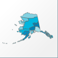 |
Map: Alaska |
|---|---|
| File Path: usa\states\counties\ak.amap | |
| Bounds: (-178.215026855469,71.4066467285156,-129.990539550781,51.5844345092773) | |
| Default Projection: orthographic |
Map Built-In Data Table
| REGION_ID (K) | REGION_NAME (K) | CENTROID_X | CENTROID_Y |
|---|---|---|---|
| 02013 | Aleutians East | -161.874000549316 | 55.6420783996582 |
| 02016 | Aleutians West | -172.152526855469 | 52.7967987060547 |
| 02020 | Anchorage | -149.26097869873 | 61.1135749816895 |
| 02050 | Bethel | -163.022674560547 | 60.4419269561768 |
| 02060 | Bristol Bay | -156.788879394531 | 58.757884979248 |
| 02070 | Dillingham | -158.662200927734 | 59.701244354248 |
| 02090 | Fairbanks North Star | -146.274841308594 | 64.8544464111328 |
| 02100 | Haines | -135.409286499023 | 58.9889469146729 |
| 02110 | Juneau | -134.164642333984 | 58.3811702728271 |
| 02122 | Kenai Peninsula | -151.653465270996 | 60.0659027099609 |
| 02130 | Ketchikan Gateway | -131.400268554688 | 55.5443000793457 |
| 02150 | Kodiak Island | -154.355438232422 | 57.7974662780762 |
| 02164 | Lake and Peninsula | -156.646392822266 | 58.288782119751 |
| 02170 | Matanuska-Susitna | -149.713401794434 | 62.3296298980713 |
| 02180 | Nome | -165.61710357666 | 64.7667465209961 |
| 02185 | North Slope | -153.914909362793 | 69.7028121948242 |
| 02188 | Northwest Arctic | -159.714416503906 | 66.8572463989258 |
| 02201 | Prince of Wales-Outer Ketchikan | -131.890274047852 | 55.5347366333008 |
| 02220 | Sitka | -135.515426635742 | 57.0755443572998 |
| 02231 | Skagway-Yakutat-Angoon | -136.680961608887 | 58.6808280944824 |
| 02240 | Southeast Fairbanks | -144.350234985352 | 63.8672904968262 |
| 02261 | Valdez-Cordova | -144.869606018066 | 61.4976692199707 |
| 02270 | Wade Hampton | -163.199028015137 | 62.0984973907471 |
| 02280 | Wrangell-Petersburg | -132.699836730957 | 56.5329189300537 |
| 02290 | Yukon-Koyukuk | -151.022644042969 | 65.2029495239258 |
![]()