Alabama Map Reference
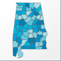 |
Map: Alabama |
|---|---|
| File Path: usa\states\counties\al.amap | |
| Bounds: (-88.4729232788086,35.0159492492676,-84.8940887451172,30.2334003448486) | |
| Default Projection: orthographic |
Map Built-In Data Table
| REGION_ID (K) | REGION_NAME (K) | CENTROID_X | CENTROID_Y |
|---|---|---|---|
| 01001 | Autauga | -86.6592254638672 | 32.5164737701416 |
| 01003 | Baldwin | -87.7068748474121 | 30.7802438735962 |
| 01005 | Barbour | -85.4000778198242 | 31.890251159668 |
| 01007 | Bibb | -87.1513137817383 | 33.0423278808594 |
| 01009 | Blount | -86.6357269287109 | 34.0146331787109 |
| 01011 | Bullock | -85.7058525085449 | 32.0955209732056 |
| 01013 | Butler | -86.6789245605469 | 31.7498512268066 |
| 01015 | Calhoun | -85.8333320617676 | 33.7661247253418 |
| 01017 | Chambers | -85.3598861694336 | 32.9256172180176 |
| 01019 | Cherokee | -85.6196212768555 | 34.2307968139648 |
| 01021 | Chilton | -86.6953048706055 | 32.8723735809326 |
| 01023 | Choctaw | -88.1996040344238 | 32.008641242981 |
| 01025 | Clarke | -87.8378028869629 | 31.5959739685059 |
| 01027 | Clay | -85.908634185791 | 33.2972393035889 |
| 01029 | Cleburne | -85.5969123840332 | 33.7152442932129 |
| 01031 | Coffee | -85.992244720459 | 31.4145946502686 |
| 01033 | Colbert | -87.7768287658691 | 34.7378044128418 |
| 01035 | Conecuh | -87.0431175231934 | 31.4736099243164 |
| 01037 | Coosa | -86.2652053833008 | 32.9327220916748 |
| 01039 | Covington | -86.4431037902832 | 31.2645931243896 |
| 01041 | Crenshaw | -86.3210945129395 | 31.7542934417725 |
| 01043 | Cullman | -86.7795944213867 | 34.0880565643311 |
| 01045 | Dale | -85.6060676574707 | 31.4148855209351 |
| 01047 | Dallas | -87.1388893127441 | 32.3786907196045 |
| 01049 | De Kalb | -85.8215789794922 | 34.5339202880859 |
| 01051 | Elmore | -86.1411323547363 | 32.5926818847656 |
| 01053 | Escambia | -87.1586036682129 | 31.1346197128296 |
| 01055 | Etowah | -86.0529708862305 | 34.0301914215088 |
| 01057 | Fayette | -87.6840400695801 | 33.7257766723633 |
| 01059 | Franklin | -87.8490028381348 | 34.4465103149414 |
| 01061 | Geneva | -85.8342132568359 | 31.0994720458984 |
| 01063 | Greene | -87.9584159851074 | 32.8415603637695 |
| 01065 | Hale | -87.6444282531738 | 32.7511653900146 |
| 01067 | Henry | -85.2298011779785 | 31.5579051971436 |
| 01069 | Houston | -85.3547744750977 | 31.1670789718628 |
| 01071 | Jackson | -85.966968536377 | 34.7371978759766 |
| 01073 | Jefferson | -86.9297904968262 | 33.5466651916504 |
| 01075 | Lamar | -88.108283996582 | 33.7950668334961 |
| 01077 | Lauderdale | -87.7012481689453 | 34.8779373168945 |
| 01079 | Lawrence | -87.3160820007324 | 34.5560665130615 |
| 01081 | Lee | -85.3463745117188 | 32.581428527832 |
| 01083 | Limestone | -87.023796081543 | 34.7837371826172 |
| 01085 | Lowndes | -86.6559257507324 | 32.1895475387573 |
| 01087 | Macon | -85.724723815918 | 32.4197006225586 |
| 01089 | Madison | -86.5151557922363 | 34.7359580993652 |
| 01091 | Marengo | -87.7920532226563 | 32.2723636627197 |
| 01093 | Marion | -87.918155670166 | 34.1192626953125 |
| 01095 | Marshall | -86.3205909729004 | 34.3559265136719 |
| 01097 | Mobile | -88.1821250915527 | 30.7543659210205 |
| 01099 | Monroe | -87.34765625 | 31.5388355255127 |
| 01101 | Montgomery | -86.2148933410645 | 32.2412910461426 |
| 01103 | Morgan | -86.828197479248 | 34.4977264404297 |
| 01105 | Perry | -87.2702255249023 | 32.5932235717773 |
| 01107 | Pickens | -88.0867729187012 | 33.2630271911621 |
| 01109 | Pike | -85.9319648742676 | 31.8467884063721 |
| 01111 | Randolph | -85.4420852661133 | 33.310791015625 |
| 01113 | Russell | -85.1636276245117 | 32.2941379547119 |
| 01115 | St. Clair | -86.3133735656738 | 33.6934642791748 |
| 01117 | Shelby | -86.6841278076172 | 33.290168762207 |
| 01119 | Sumter | -88.1312675476074 | 32.6488876342773 |
| 01121 | Talladega | -86.14599609375 | 33.4037590026855 |
| 01123 | Tallapoosa | -85.7976989746094 | 32.8090419769287 |
| 01125 | Tuscaloosa | -87.4477272033691 | 33.3152122497559 |
| 01127 | Walker | -87.2972221374512 | 33.7638072967529 |
| 01129 | Washington | -88.175651550293 | 31.4113922119141 |
| 01131 | Wilcox | -87.2630233764648 | 32.0537586212158 |
| 01133 | Winston | -87.374080657959 | 34.1538009643555 |
![]()