ESRI ShapeFile (SHP) Support
Overview
The ESRI Shapefile or simply a shapefile is a popular geospatial vector data format for geographic information systems, it likely that your company or organization have maps of the regions of interest in this format.
AnyChart gives you an ability to put this maps to WEB - using AnyChart Maps and Adobe Flash Technology.
All you need to do is to obtain a map in ShapeFile format and refer to AnyChart Map Converter Page: http://6.anychart.com/products/anymap/converter/.
In this article you will learn why AMAP format is used by AnyChart and see a sample of a custom map.
![]()
ShapeFile (SHP) Format
The ESRI Shapefile or simply a shapefile is a popular geospatial vector data format for geographic information systems software. It is developed and regulated by ESRI as a (mostly) open specification for data interoperability among ESRI and other software products. A "shapefile" commonly refers to a collection of files with ".shp", ".shx", ".dbf", and other extensions on a common prefix name (e.g., "lakes.*"). The actual shapefile relates specifically to files with the ".shp" extension, however this file alone is incomplete for distribution, as the other supporting files are required.
Shapefiles spatially describe geometries: points, polylines, and polygons. These, for example, could represent water wells, rivers, and lakes, respectively. Each item may also have attributes, that describe the items, such as the name or temperature.
![]()
AMAP Format
".amap" files are maps encoded in a proprietary AnyChart AMAP format created to store geographical data. Each ".amap" file contains a single map, for example: Map of the USA or Map of the World.
Why AnyChart uses AMAP and not ESRI directly? There are three main points:
- AMAP Files are optimized for WEB
- AMAP Files contain only required information
- AMAP Files ship one map in single file
Why do these points are important?
- Even a simple map contains thousands of points and being uncompressed and unsimplified (as usually in shp files) it is very voluminous can be displayed only by special software.
AnyChart simplifies the map, making it still recognizable and suitable for demonstration and statistical purposes and small enough to be downloaded by users browser without noticeable delay. - ShapeFile usually contains not only region borders and identifiers, but also a lot of other information - when amap file is created it contains only information that is necessary - this also decrease the size of a map.
- Dealing with the deployment of one file for one map is easier than storing a number of shx, dbf, shp, etc. files.
Important Note
AnyChart AMAP Maps are not intended for use in applications that require precise geo-positioning, they are intended for demonstration, statistical and educational purposes only.
Although we give users an ability to place points according to their latitude and longitude - we do not guarantee any accuracy that can be crucial for certain kinds of applications.
Maps shipped in package and generated by converter are simplified - which means that some points from polygons (region borders for example) are removed, so you can not rely on them as on the source of inevitable information about countries or region borders.
![]()
Conversion
Conversion of ShapeFiles to AMAP can be done by AnyChart Map Converter, in order to convert your map please do the following:
- Choose a map (or maps) you want to convert and locate all the required files: SHP, DBF, SHX.
- Choose an information you want to be attached to map regions (i.e. Name, Id, Area, Population, etc...)
- Obtain the AnyChart Map Converter and refer to its help file.
AnyChart Map Converter Page: http://6.anychart.com/products/anymap/converter/
![]()
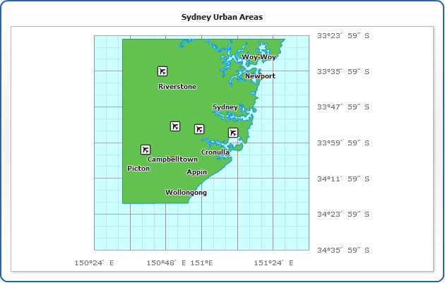
Sample Custom Map
Please take a look at the sample custom map of Sydney (Australia) converted from SHP to AMAP and now displayed by AnyChart Map:
![]()